Riley Carr ‘22
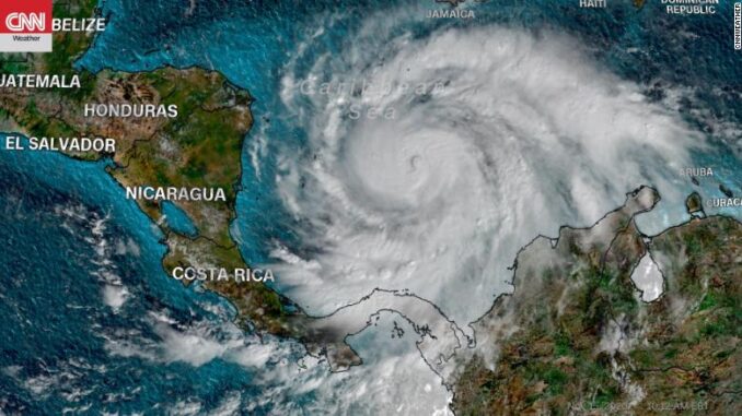
This past November, a powerful hurricane surfaced in South America; more specifically along the coastline of the Colombian island San Andres. This was no ordinary hurricane, as it fell under Hurricane Category 5. The wind speed during Hurricane Iota reached approximately 160 miles per hour; therefore causing additional chaos.
As for the effect on residents living in the midst of this disaster, there were two people reported dead, six people said to be in critical condition, and one missing. These are relatively low statistics compared to other natural disasters. However, any phenomenon that results in casualties is something to take seriously.
Here are some things to keep an eye out for when analyzing a top tier storm like Iota. There are usually images shared through the media of a projection of the storm. In a forecast provided by The Washington Post, Iota’s furious eyewall was crackling with electricity; a rarity in tropical storms and hurricanes. Typically, the upward current and sideways spiral of air is unable to induce charge severance, which increases the chance of lightning. This was not the case with Iota, however. When a hurricane produces frequent lightning in its eyewall, it is most likely a forceful storm.
Hurricane Iota surpassed many records after its destruction in South America, and also was the strongest storm ever recorded so late in the hurricane season. This particular natural disaster affected major components of the Colombian island society by the destruction of roads, as well as the death and injury of the natives.